Followers

Saturday, September 06, 2008

Dive in Paradise – Payar Island , Langkawi .

Pulau Payar
and its adjacent islands are some of the few locations for good diving off the West Coastof Peninsular Malaysia .Divers flock here during the monsoon season in the East Cost ,making Payar but one example of Malaysia’s year-round diving destinations. Large number of coral species lie embedded here ,both hard and soft.Their colour and variety provide good opportunities for photography ,comparable to some East Coast destinations .


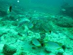
A large ,permanent pontoon offshore is a great stopover for its many amenities is a great stopover for its many amenities and the panoramic view.From here ,traveling to the dive sites is a matter of minutes .At Coral Garden ,you will be enthralled by the colourful soft corals and many reef fish varieties .Next to it is Grouper Farm ,a site renowned for its many groupers,snappers and even barracudas .


Futher out to the west ,limited wall-diving opportunities also exist around to tiny Pulau Segantang .Reef life here range from the many anemones at Anemone Garden to the snappers ,jacks ,and barracudas at Tyre Reef .

How to getting there ? You can buy ticket at Kuah Jetty counter .Many packaged there and many agent .


Day trips are the only way of discovering Payar,although limited accommodation not available here .However ,nearby Langkawi ,the main island ,makes an ideal launch pad .Journeys take from 45 minutes to an hour,depending on the sea conditions.With Langkawi’s duty-free status and multitude of activities ,there will be plenty to see and do to spice up your holiday .

Climate and Water Temperature
Malaysia has an equatorial climate with fairly uniform temperatures ranging from 32°C during the day to 22°C at night .Humidity is about 85 to 95 per cent . Water temperature is 27 - 28°C and during the dry months the temperature may rise to 30 - 31°C . Divers will not require thick wet suits . A wet suit of between 1.5 to 3 millimetres is appropriate .
Best times to Dive
West Coast of Peninsular Malaysia – December – May
East Coast of Peninsular Malaysia – March – October
The island around Sabah and Sarawak are reasonably well protected and can be dived all year round . However ,water visibility is better during the months of April to August .


Monday, September 01, 2008

Langkawi Island - Lakes of Langkawi

A lake is generally interpreted as a water body of considerable size surrounded entirely by land. Lakes can be formed naturally or can be artificially formed .Tasik Empangan Malut is an artificial lake created by flooding the Malut drainage system for purpose of domestic use .There are several naturallakes in Langkawi .Tasik Dayang Bunting ( Lakes of The Pregnant Maiden ) is the Largest one,followed by Tasik Langgun and several smaller and unnamed lakes around Tanjung Rhu – Kisap area .All natural lakes in LAngkawi are associated with limestone landform and thus their origin was interpreted as a formation of sinkhole in limestone .


There are number of natural processes that can form lakes.Newly tectonically uplifted terrains create mountain range with bowl-shaped depressions that could accumulate water to form lakes.The advancement and retreat of glaciers can scrape depressions on the ground that could contain water to form lakes .Lakes can also be formed by means of a landslide or by glacial blockages.Small ,crescent shape lakes called oxbow lake can be formed as a result of a eander cut-off . Some lakes lie along continental rift zones, and are created by subsidence of the areas in between two plates that are pulling apart .

These pull-apart lakes are among the oldest and deepest in the world ,and may be destined over millions of years to become oceans .Th Red Sea is thought to have originated as a rifted valley or a pull-apart lake .Crater lakes are water body trapped within volcanic calderas or meteor craters .Some lake come into existence as a result of sinkhole activities and the collapse of large underground caves .

Visitor taking a dip in the cool waters of Tasik Dayang Bunting


Sinkhole ,also known as do line is one of the common landscape features on limestone bedrock .It usually formed due to the collapse of the cave roof .The result in this case is a depression on the surface topography .This may range anywhere from a small ,gentle earth-lined depression ,to a large ,cliff-lined chasm.Most often there is a small area of rock exposure near or at the bottom of a sinkhole,and an opening into the cave below may or may not be visible .In the case of exceptionally large sinkholes, there may be a stream or river flowing into the floor of the sink from one side and flowing out from the other .


Not all of the dolines in Langkawi are filled with permanent water body. Some are just ephemeral lakes,which is water-log only for a few days following heavy precipitation.Tasik Jantan, which is located next to the Tasik Dayang Bunting is one of them,and some others are in Tanjung Rhu .There are some underground cracks that possibly allow water to seep out of the lake .Such lakes often form important isolated wetlands that are very rich in biodiversity .


Only Tasik Dayang Bunting and Tasik Langgun are fresh water lakes ,whereas others smaller lakes are intermittently connected with sea-water during the spring tide and thus contain salty sea water .Water from the sea enters the lake through large cracks,underground coves or tunnels . ..By Kamal Roslan Mohamad